Collaborative Mapping Platform
Augmented maps for
collaborative storytelling
Cityopensource develops participatory processes and engages inhabitants in digital storytelling and collaborative mapping projects, promoting community building and knowledge sharing.
46
Active Maps
14.0K
Geo-Media
10.1K
Data Points
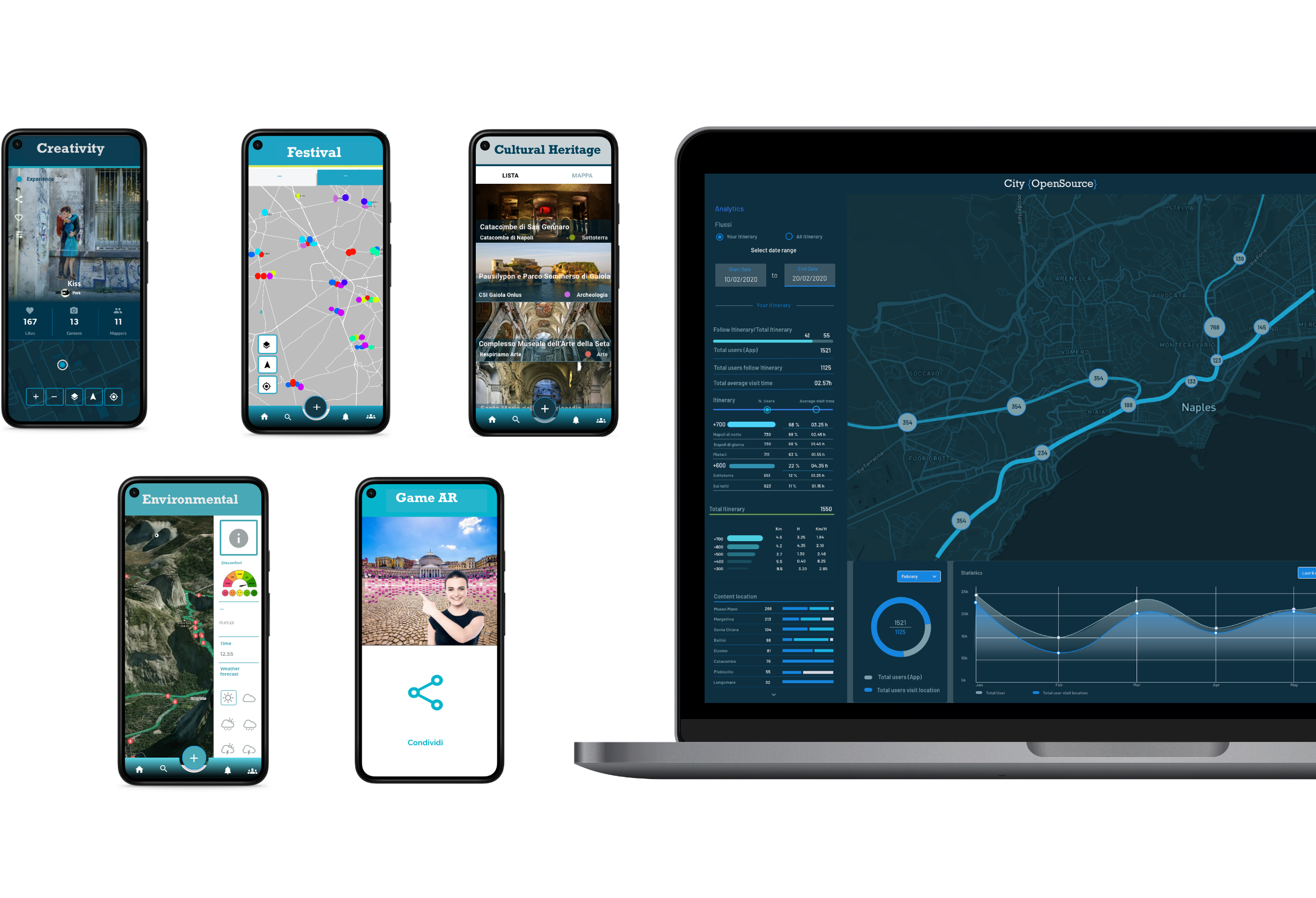
Empower your Community
From participatory processes and research projects to urban activation and community tourism, discover how to leverage collaborative mapping.
Engage & Participate
- Multi-mapper collaboration
- Geo-localized push alerts
- Community gamification
Analyze & Reuse
- AI Image & Text recognition
- Data export & Open API
- Quantitative mapping insights
Open Projects
Discover and participate in active projects globally. Every location tells a story.

Co-design Solutions
Our platform is the result of collaborative research and experimental development. We activate co-design labs to create customized experiences that generate value for communities, public entities, nonprofit organizations, and SMEs
Contact Our TeamNeaples, Italy
Blog


Spazio al Futuro: tecnologie, dati, opportunità
29/05/2026
Road to Hackathon Opentusk 2026
12/05/2026
White paper su Turismo & innovazione di RePower
15/04/2026

Foggia 900
10/03/2026